

You can find on this page the blank map of Norway to print and to download in PDF. The contours map of Norway presents the international boundary of Norway in Northern Europe. You can use the vector map of Norway for personal or educational use.

The blank map of Norway shows the country Norway empty. This blank map of Norway will allow you to use the map for personal activities or educational with children for example (drawing). The empty map of Norway is downloadable in PDF, printable and free.
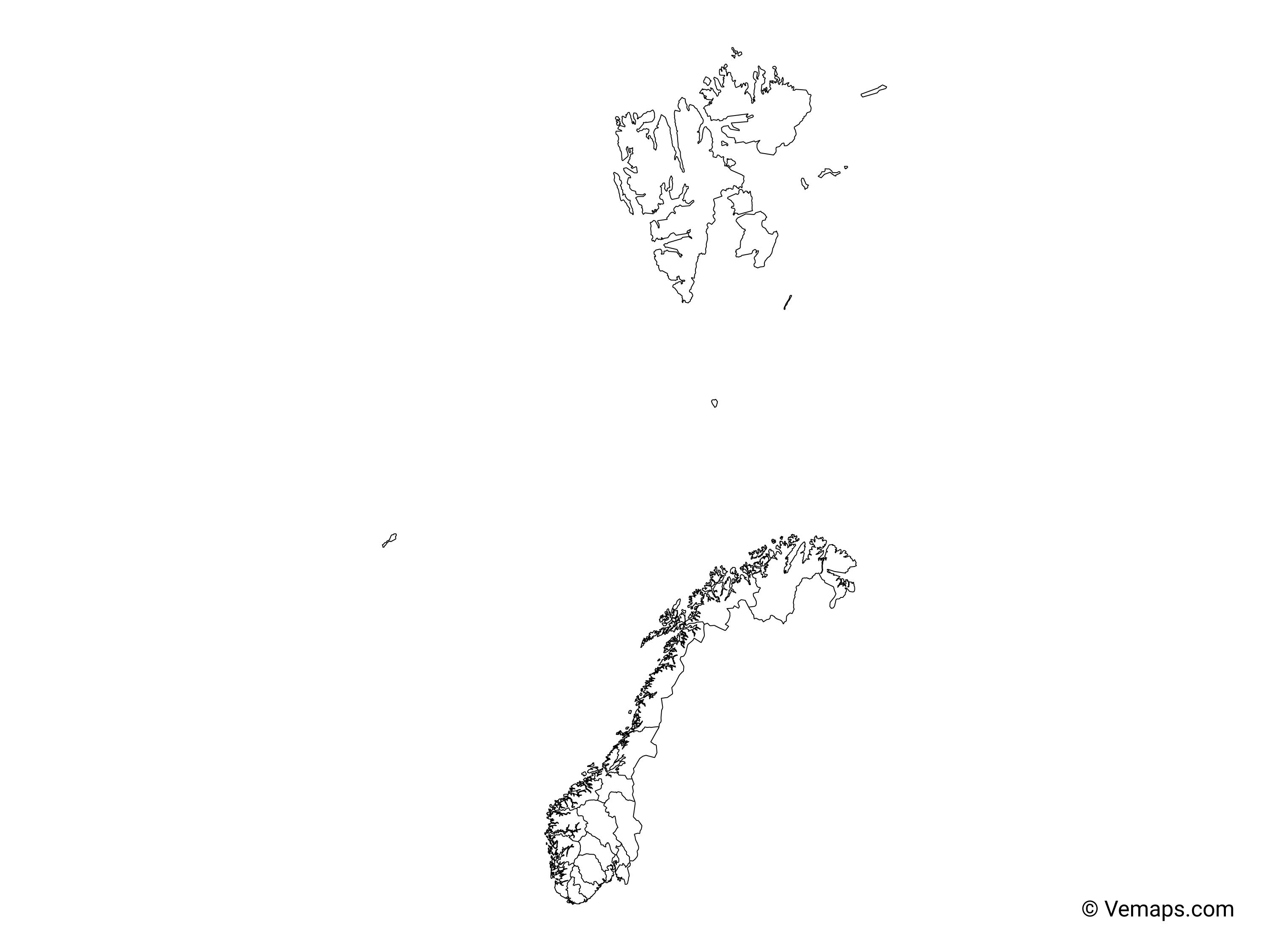
The Blank map of Norway or officially the Kingdom of Norway is located in Northern Europe. It is a Nordic country whose mainland territory is comprised of the northernmost and western portion of the Scandinavian Peninsula. Not only the Scandinavian Peninsula but Norway territory also includes the remote Arctic island of the archipelago of Svalbard and Jan Mayen. Bouvet Island, located in the Subantarctic, and the Antarctic territories of Queen Maud Land and Peter I Island are also claimed by Norway.
There are a number of informal subdivisions that sometimes also play a political role: Regions, known in Norway as landsdeler (singular landsdel), of which there are five as you can see in the Blank map of Norway: Nord-Norge, Østlandet, Sørlandet, Trøndelag, and Vestlandet. Alternately, one may subdivide the country into North, Middle and South: Nord-Norge, Midt-Norge and Sør-Norge. The second region consists of Trøndelag plus one of the Vestlandet counties, while the rest of the country ends up in the last region. Districts, typically organized by common language, culture, or geographical barriers. There is no fixed number, as the boundaries are interpreted in subjective ways. The Sápmi region is the Sámi "homeland" that spans across North Europe. In Norway, Nord-Norge is commonly included, along with the northern and inner parts of Trøndelag, and sometimes the northernmost parts of Østlandet. While the region has not been defined by any Norwegian law, 12 of the Sámi electoral constituencies are located roughly within the Sápmi region - the southernmost of the twelve being called the South Sámi Area, and the entire region south of this South Norway.
There are lots of things that make Norway a unique country. For example, Norway is blessed with amazing natural wonders. Norway has natural beauties that are carefully preserved in their true form and are rugged. People around the world know Norway for its unique traditions and distinctive culture which attracts millions of tourists to this country. Norway is famous for many things. One can see the northern lights which feel like a magical experience. The northern lights are so beautiful that people viewing this are mesmerized by it. Vikings who were popular for their horn-equipped helmets originated from Norway. The below provided Blank map of Norway will provide valuable information about the country.
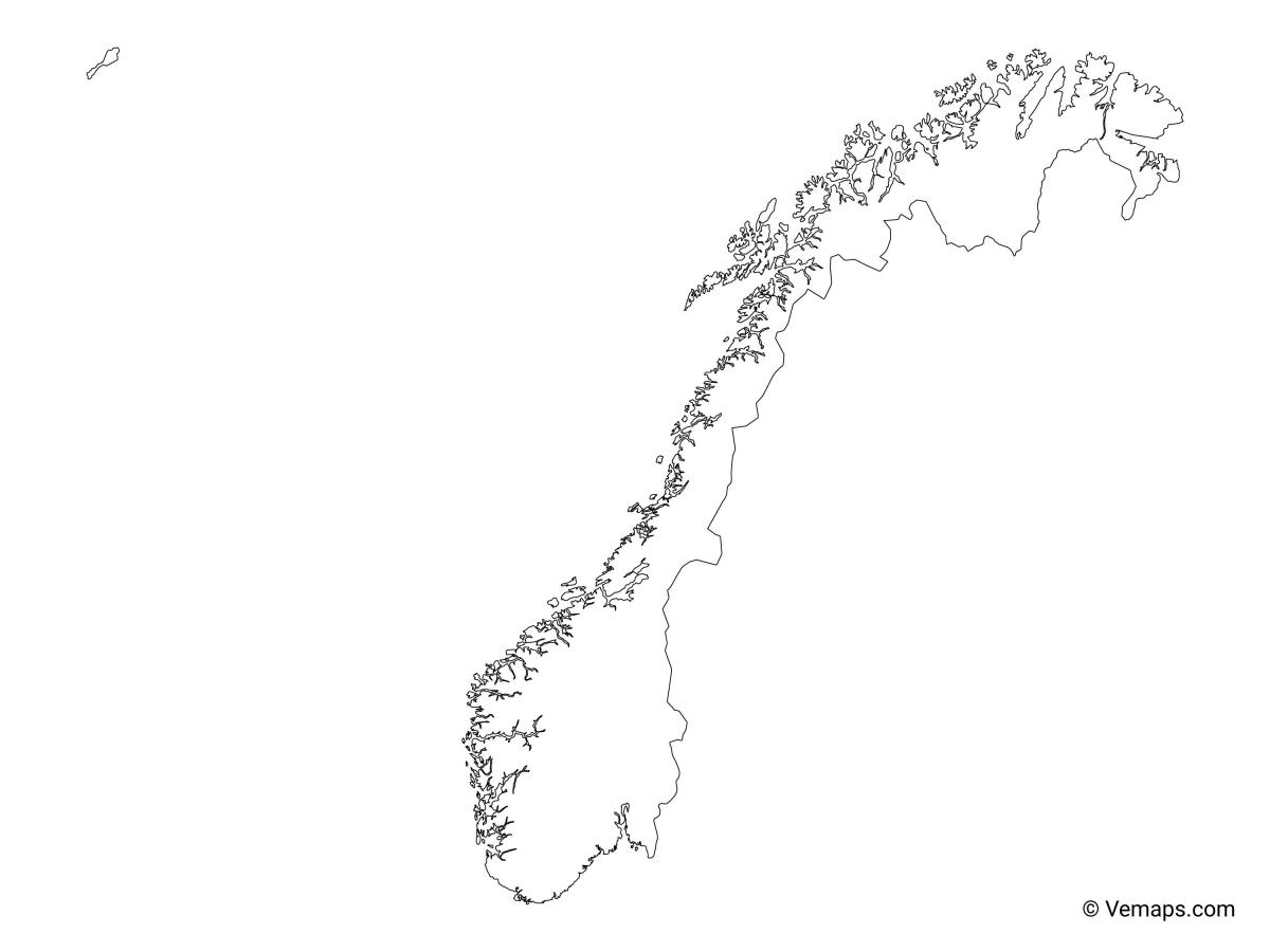
The Norway map outline shows all the contours and international boundary of Norway. This outline map of Norway will allow you to easily learn about neighboring countries of Norway in Northern Europe. The Norway contours map is downloadable in PDF, printable and free.
Not only the country but the people of this country are also very beautiful. Norway people are gorgeous with blue eyes and perfect height. Norway people are believed to be very faithful and loyal towards their partners and can be a good friend. It is very interesting to note that the country is famous for exporting tap waters. Norway has the maximum number of medals in the Winter Olympics compared to any other country in the world (see Norway map outlines).
The “Land of the midnight sun”, Norway has its northern part located in the Arctic circle which has 24 hours of sunshine for complete two months( May and June). Norway has the longest days on earth which lasts for weeks. The country has the longest road tunnel which is 24.5 km in the world as its mentioned in Norway map outlines.
Norway is the happiest country in the world. The government of Norway provides free education to its citizens, health care facilities, public pension, and many more basic benefits. The country has an honest political system with little or no corruption at all, provides the freedom to its citizens, and social support. The country has the largest battery-powered vehicles running on the roads as its shown in Norway map outlines. The crime rates are considerably very low. Police here does not carry gun along with them rather they keep it in police car locked. The country is famous for Trolltunga known for its scenic beauty and perfect picture-taking spot.

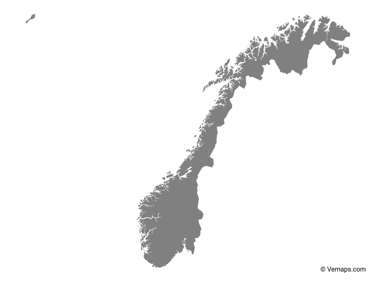
The vector map of Norway shows entire surface of Norway empty. This vector map of Norway will allow you to make changes or add details to the map of Norway in Northern Europe, for personal or educational purposes. The vectorial map of Norway is downloadable in PDF, printable and free.
Norway elongated shape, numerous geographical barriers, and distributed population barriers has led to a number of conventions for it subdivisions as you can see in Norway map vector. These have changed somewhat over time, and various reforms are under continuous consideration. The shape of a state is determined by the political boundaries and geography that determine its territory, and that shape impacts the politics and economies of the state. The six categories of state shapes are: compact; elongated or attenuated; fragmented; prorupted or protruded; perforated; and compound or complex.
Norway map vector can be used by students for map-pointing activities or coloring, which forms a part of education in the subject of Geography. Norway is a country based in the region of Northern Europe and officially designated as the Kingdom of Norway. The mainland of Norway comprises the northernmost and western portion of the Scandinavian Peninsula which is a Nordic country. The remote Arctic island of the archipelago of Svalbard and Jan Mayen are included in Norway territory. Bouvet Island, located in the Subantarctic, and the Antarctic territories of Queen Maud Land and Peter Island, are also claimed by Norway.
Norway map vector is considered as a key source for any user who is just learning to draw a full-fledged map of the country. It is essential for the user to gain access to a good and clear the Norway map vector, so that he or she can successfully execute this task. It acts as guideline for the user to an accurate map of the country.